Aerial Map Lubbock Aera Veterans War Memorial
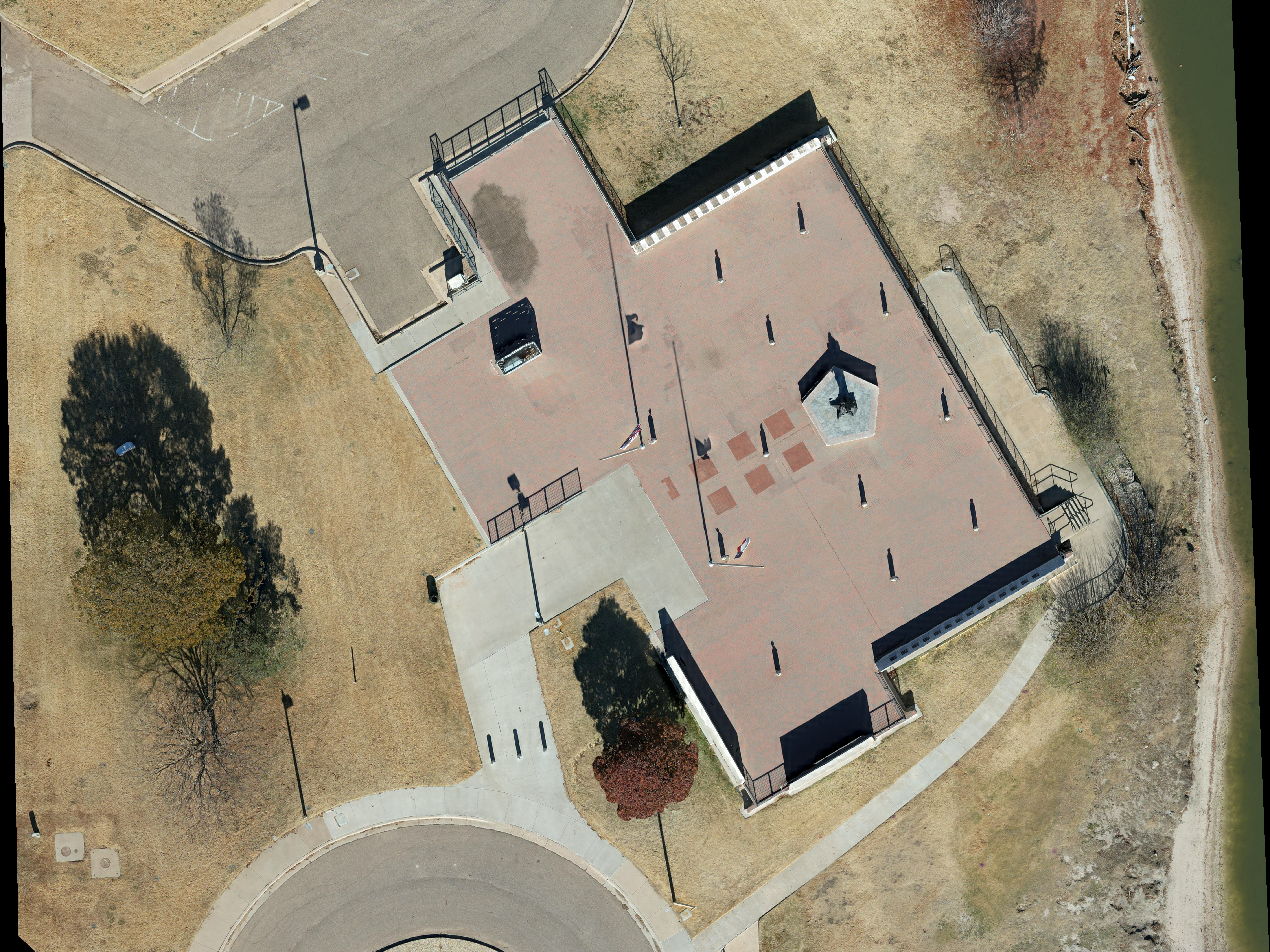
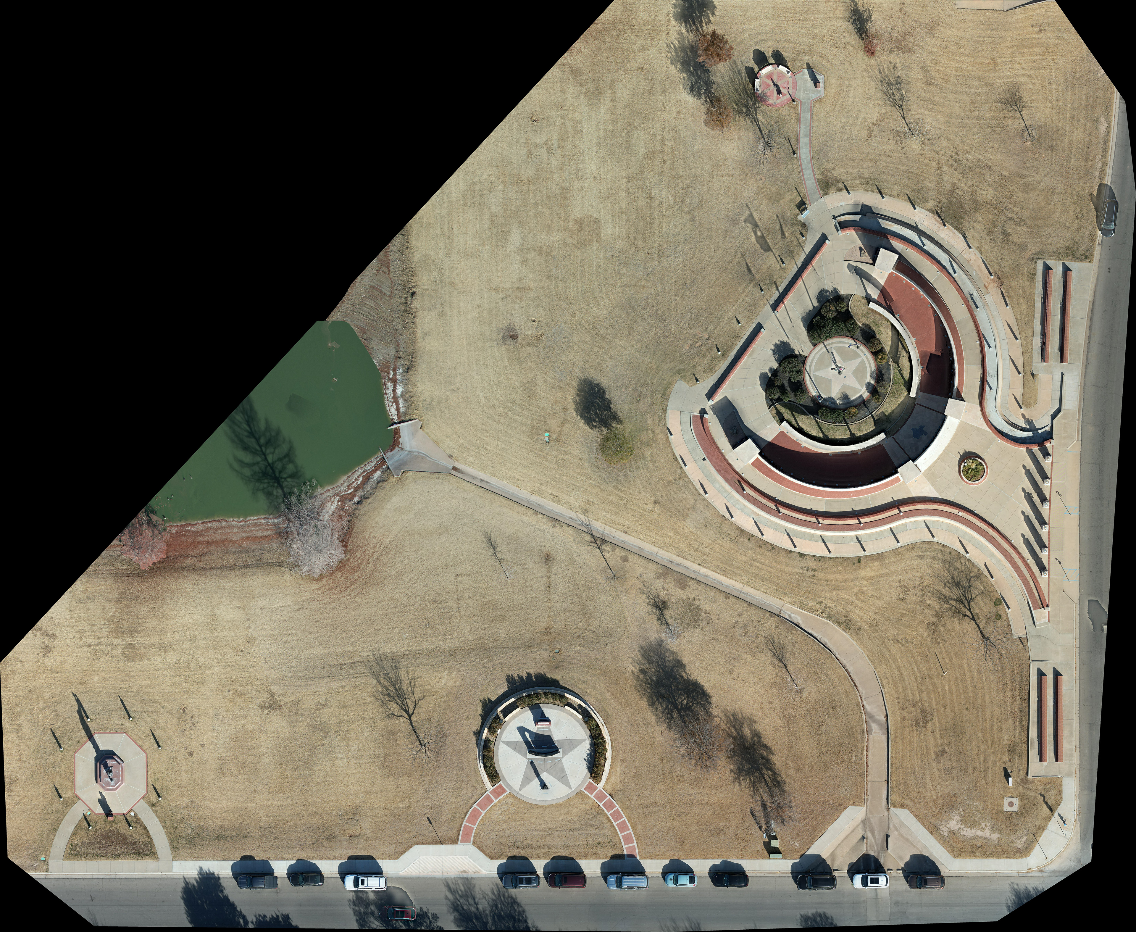
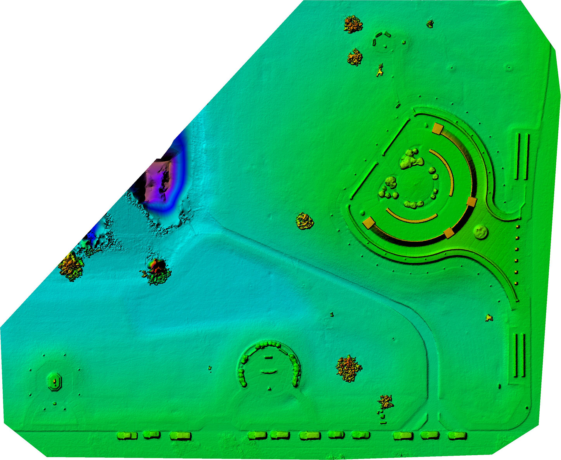
An aerial orthomosaic map and digital surface model of the LAVWM. The 3.53 acre map is comprised of 221 images taken at an altitude of 185ft. The resulting Ground Sampling Distance is 0.51 inch per pixel. An elevation range of 2,851.5 to 2,946.9 feet is observed.Default center Latitude is 33.5185954 and default center Longitude is -101.8986407
You may also like
Lubbock by Air Episode 2 Video
2022
Aerial Map Lubbock Regional Public Safety Memorial
2023
Windmill Museum by Air
2022
Cinematic Home Tour 4606 21st Street Lubbock
2023
501 Winery Childress, Texas
2022
SPAI - Cinematic Home Tour Service
2021
Aerial Photography 1626 Cherry Hill Drive Anna, TX
2022
Water Rampage Lubbock Aerial Photography Suite
2023
Dunbar Historical Lake - Lubbock, TX
2021
Aerial Photography 5716 75th Street Lubbock, TX
2023